



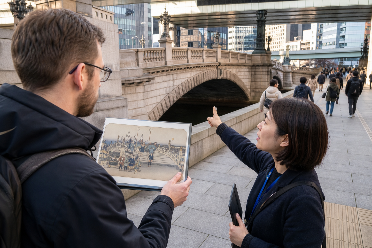
Checked: August 26, 2026. A landscape print can begin an Edo-period journey, but it is not a route map or a promise that today’s view is unchanged. This guide uses Nihonbashi, Hakone Checkpoint and Yui to show how to compare ukiyo-e travel images with roads, barriers, post towns and present-day access—without treating Hiroshige’s Tokaido series as documentary photography.
A famous-place print is designed travel media, not a photograph
Hiroshige and other artists compressed distance, shifted viewpoints, emphasized weather and chose figures that made a place legible. A publisher sold a series to an audience interested in movement and famous places. Begin with the title and station, then ask what has been enlarged, omitted or arranged. The right question is not “Where is the exact camera spot?” but “What did this image teach its audience to notice?”
Edo travel involved permissions, money, labour and risk
| Element in a print | Historical question |
|---|---|
| Porters, horses and palanquins | Who carried people and goods, and who paid? |
| Post-town shops and inns | Which services supported travellers, officials and commercial traffic? |
| Barriers and inspectors | How did the shogunate monitor movement and political security? |
| Rain, snow, slope or river | How did weather and terrain change time, cost and danger? |
| Mt. Fuji or a famous landmark | Was it a navigational presence, sacred landscape, commercial motif—or all three? |
Travel was not equally free. Status, gender, official duties, pilgrimage, finance and permits shaped mobility. Do not convert cheerful roadside figures into a claim that every journey was leisurely tourism.
Nihonbashi: begin at the road origin, not a replica of Edo
The first bridge was built in 1603, and Nihonbashi was designated the starting point of the five major roads in 1604. Today’s stone bridge dates to 1911 and carries Japan’s road-origin marker; it is an Important Cultural Property and an active street. Access: Nihombashi Station on the Ginza, Tozai and Asakusa lines, or Mitsukoshimae Station. Admission/closing: the public bridge has no admission or closing day, but traffic, construction and river operations vary. Stand clear of the carriageway and cycle flow. Compare prints of bridge commerce with today’s road, river and surviving commercial district rather than expecting wooden Edo scenery.
Hakone Checkpoint: test the journey against terrain and control
Address: 1 Hakone, Hakone-machi, Kanagawa. Access: about 55 minutes by bus from Odawara Station to Hakonemachi, then 2 minutes on foot; delays are common on busy roads. Hours: 9:00–17:00, Dec.–Feb. to 16:30; last admission 30 minutes before closing. Admission: adult ¥500, elementary-school child ¥250; official discounts vary. Open all year according to the current English page, but check temporary notices. Standard visit about 45 minutes. Food, drink and smoking are prohibited; take rubbish home. The restored facility is based on documentary research and excavation, but it is not an untouched Edo building. Official visitor information
Yui connects Hiroshige to a post town—but the museum is closed now
The Shizuoka City Tokaido Hiroshige Museum stands at Yui Honjin Park in the former sixteenth post town. Address: 297-1 Yui, Shimizu, Shizuoka. Access: about 25 minutes on foot east from JR Yui Station along the old Tokaido, or 5 minutes by taxi. Critical current status: the museum is closed for renovation from June 1, 2026 through the end of March 2027. Do not travel expecting galleries, shop, toilets or standard admission. Normal information after reopening is 9:00–17:00, last entry 16:30; adult ¥520; Monday/holiday-following and Dec. 28–Jan. 4 closures, but reopening terms must be reconfirmed. The post-town streets remain living roads, not a substitute museum. Official closure and visit page
Choose one achievable comparison route
| Plan | Recommended sequence | Boundary |
|---|---|---|
| Tokyo 60–90 min | Nihonbashi bridge, road marker and river edge; compare one public-domain collection image offline. | Active roadway; no promise of an Edo view. |
| Hakone half day | Checkpoint exhibition, lakeside rest and only a safe permitted part of the old-road environment. | Bus congestion, mountain weather and slopes require buffer. |
| Yui after reopening | Museum first, then a short old-Tokaido observation walk. | Unavailable during the June 2026–March 2027 closure. |
| Multi-day Tokaido study | Nihonbashi, Hakone and Yui on separate days with current rail/bus bookings. | Do not imitate an Edo walk on modern highways. |
Use four layers to compare print and place
- Title: identify the series, station and impression rather than trusting a cropped social-media image.
- View: mark mountains, water, road and buildings, then note artistic rearrangement.
- Movement: identify walkers, carriers, horses, boats and control points.
- Present evidence: separate surviving landscape, reconstruction, later monument and modern tourism infrastructure.
A modern sign saying “old Tokaido” is evidence of remembrance, not proof that every stone and façade is Edo-period.
Old roads are not automatically safe walking trails
Parts of former routes now share narrow roads with cars, climb slippery stone paving or lack pavements and lighting. Use official trail maps, check buses and weather, wear grip footwear and turn back before dark. Never walk through tunnels, expressways, railway land or private gardens to reproduce a print angle. In Hakone, fog, heat, snow and heavy rain can change conditions quickly; an artwork is not a navigation tool.
Post towns and bridge districts are living communities
Do not photograph through windows, block a shop entrance, sit on private steps, fly a drone or treat residents as costume extras. Ask before portraits and commercial photography. At monuments, keep tactile paving and crossings open. Buy locally when useful, but do not claim a modern snack or craft is “exactly what Hiroshige experienced” without evidence. Take rubbish away when no suitable bin exists.
A five-minute print-to-place checklist
- Save the full collection record: artist, title, series, date, publisher and institution.
- Confirm the destination’s current opening, renovation, fee and transport notices.
- Choose one comparison question—terrain, labour, control, commerce or weather.
- Download a current map; do not navigate from the composition.
- Label your own photos as present-day comparisons, not reconstructed proof.
Ukiyo-e does not let us “travel back unchanged.” It offers something better: a designed historical viewpoint that can be tested against roads, institutions, memory and communities that continue to change.