



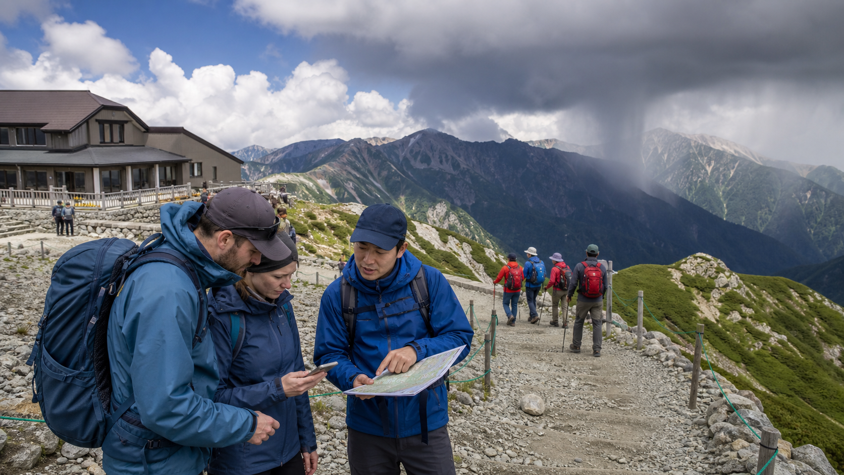
Information checked: August 26, 2026. “The Japan Alps” is not one trail or one climate. The Hida (Northern), Kiso (Central) and Akaishi (Southern) ranges span different terrain, and a riverside walk in Kamikochi is not equivalent to sightseeing around 2,450-meter Murodo or climbing an exposed 3,000-meter ridge. Choose the activity level first; only then decide whether the season and today’s weather fit it.
First separate valley walking, highland sightseeing and alpine climbing
| Level | Typical example | What it requires |
|---|---|---|
| Managed valley walk | Kamikochi bus terminal–Kappa Bridge–Taisho Pond or Myojin area | Walking shoes, rain protection, bus plan and enough daylight; closures and wildlife still matter |
| Transport-assisted highland | Murodo station area and marked loops | Warm/waterproof layers, altitude awareness, last-transport deadline; lingering snow can remain |
| Alpine route or summit | Exposed ridges, chains/ladders, hut-to-hut traverse | Route-specific skill, map/navigation, early start, plan submission, hut booking and conservative weather threshold |
A bus or cable car removes part of the ascent, not the altitude, wind, UV, snowfield or rescue consequences. Conversely, visiting a valley does not automatically constitute mountaineering. Do not let the word “beginner” cross these boundaries: a technically easy trail can become serious in rain, darkness, residual snow or closed-season conditions.
Why a sunny station forecast is not a summit forecast
As elevation increases, temperature commonly falls, but a fixed “15–20°C colder” rule is unsafe because the starting elevation, air mass, inversion, sun, wind and time of day vary. Wind and wet clothing can remove heat rapidly even in summer. Terrain forces air upward, helping cloud and precipitation form; ridges are exposed while valleys may hold fog or channel wind.
Afternoon convection can bring showers and thunder after a clear morning. JMA warns that when thunder is heard or a thundercloud approaches, lightning is imminent; summits, ridges and open ground are especially exposed, and a substantial building or enclosed vehicle is a safer refuge. A mountain hut is not a waypoint to reach after thunder begins—it should be part of an early escape plan.
There is no single “best Japan Alps month”
- Mid-April to June: transport-assisted sightseeing may reopen while snow remains at high elevation. A dry valley path does not prove a ridge is summer terrain. Snow walls are a managed attraction; nearby off-route slopes are not casual walking areas.
- July to August: many hiking services operate, but heat at lower trailheads, strong UV, thunderstorms, typhoons and crowding require early starts and alternatives. “Summer” does not guarantee frost-free 3,000-meter conditions.
- September to mid-October: cooler air and color can be attractive; daylight shortens and the first snow or ice can arrive. Hut, bus and lift closing dates may precede the season you imagined.
- Late October to winter: normal visitor transport and facilities progressively close. Entering a closed Kamikochi or high ridge is winter mountaineering, not quiet off-season sightseeing.
Typhoon approach, heavy-rain warnings, strong wind, lightning outlook, snowfall, frozen surfaces, trail damage and transport suspension all override a calendar. Autumn color and snow-wall periods are not safety guarantees.
Kamikochi: accessible valley scenery, not an all-season shortcut to the peaks
- Area/address: Kamikochi, Azumi, Matsumoto, Nagano 390-1516; Chubu-Sangaku National Park.
- Access: private cars and motorcycles are restricted year-round beyond the gate. From Matsumoto, take the Alpico railway to Shin-Shimashima and a bus; drivers transfer at Sawando. From Takayama, travel via Hirayu and transfer. Reserve services where required and verify the last return.
- Admission: no general admission fee for the natural area; trains, buses, parking, accommodation and facilities cost separately.
- 2026 season/closure: public transport and facilities began operating from the April 17 tunnel opening. Ordinary visitor services close for winter after the operating season; check the official site for the exact final bus/facility date and temporary road or trail closures.
- Recommended plan: allow 3–5 hours for a valley walk, meal and buffer rather than squeezing it between the first and last bus. Kappa Bridge is not evidence that the trail toward Yokoo or the peaks is safe.
From November 16, 2025 through mid-April 2026, the official winter notice treated entry as winter mountaineering with no normal transport, lodging or food service, and required a climbing registration at Nakanoyu Gate. This illustrates why a closed-season photo is not an invitation for ordinary tourists.
Murodo and the Tateyama Kurobe Alpine Route: high altitude by public transport
- Area: Murodo, Ashikuraji, Tateyama, Nakaniikawa District, Toyama; about 2,450 meters above sea level.
- Access: enter from Tateyama Station on the Toyama side or Ogizawa on the Nagano side using the route’s connected transport. Private cars do not traverse the route.
- Admission/price: there is no separate mountain “admission,” but each direction/segment requires transport tickets. Use the official 2026 ticket search because through, return and partial-route products have different prices and reserved boarding conditions.
- 2026 operation: April 15–November 30. Weather and safety can still suspend a segment; the late-November timetable differs from the main season.
- Recommended plan: for first-time sightseers, reserve 2–4 hours at Murodo for acclimatized, marked-path walking plus the onward transport buffer. Do not turn a station visit into an unplanned summit attempt.
Headache, nausea, unusual breathlessness, dizziness or worsening coordination at altitude require stopping, resting and informing staff; descending is more important than completing a photo route. Snow, gas around volcanic areas, closed paths and strong wind must be judged from current official notices.
Use a three-stage weather check, not one app screenshot
- 48–72 hours before: check JMA regional forecasts, warnings and typhoon information; facility and transport notices; trail/hut status; and whether the group can change dates. Do not rely on a city weather icon.
- The evening before: compare precipitation, wind, temperature and thunder timing at relevant elevations. Tell a reliable person the route and return time, submit the required/recommended climbing plan, and download maps for offline use.
- At the trailhead and during travel: read live cameras and staff notices, note cloud development and actual temperature, and set a written turnaround time tied to the last safe transport—not to sunset alone.
Keep sources in order: JMA warnings and nowcasts; prefectural/police and park closure information; operator service status; mountain-hut and local patrol observations. A crowd continuing upward is not a weather source.
Pack for the terrain level and loss of one system
- Every mountain visit: grippy closed shoes, hooded waterproof shell, warm layer, sun protection, water, food, charged phone plus power bank, offline map, cash and personal medicine.
- Long trail: headlamp even for a day trip, paper-map backup, first aid, emergency insulation, whistle, spare food/water and route-appropriate navigation.
- Snow/ice or exposed route: helmet, traction, axe or avalanche equipment only when the route requires them—and only with the knowledge to use them. Owning equipment does not create skill.
An umbrella is poor primary protection in wind and occupies a hand. Cotton that stays wet is a poor insulating layer. Do not attach bells, speakers or dangling objects without considering other users and wildlife guidance; noise is not a substitute for correct bear behavior.
Write down turn-back rules before emotion takes over
- Thunder is heard, a warning is issued, or a dark cloud/rain shaft is approaching the exposed section.
- Wind prevents steady walking, waterproof layers are failing, or a member cannot warm up while moving.
- The group reaches its turnaround time, falls behind the last transport/hut check-in plan, loses the route or encounters snow/ice beyond its equipment and skill.
- A member has persistent altitude symptoms, injury, exhaustion or impaired judgment.
- Staff, police, park managers or operators close the route. A rope, sign or suspension is not a challenge.
If in immediate danger, call 110 (police/mountain rescue coordination) or 119 (fire/ambulance) when connected, provide the trail name, last sign or hut, coordinates, injury and group condition, then conserve battery and follow instructions. Rescue may take time and may involve cost; insurance does not make a hazardous plan acceptable.
Mountain huts, trails and sacred landscapes are shared infrastructure
Japanese mountain huts (yamagoya) support safety but are not always walk-in hotels: booking, arrival deadlines, meal times, water, toilets, cash/payment and cancellation rules differ. Arrive before the stated time, report delay early, keep wet gear where directed and do not occupy emergency space for casual filming.
Stay on hardened paths to protect fragile alpine plants, carry out rubbish, use designated toilets, do not feed wildlife, and ask before flying drones or photographing people inside huts. Mountains such as Tateyama also have religious histories; gates, statues and memorials deserve the same respect as natural features. Safety and stewardship—not summit conquest—are central to enjoying the Alps.
FAQ
Can beginners visit the Japan Alps?
Yes, by choosing a managed valley or transport-assisted highland plan and staying within current conditions. “Beginner-friendly” never transfers automatically to a summit route.
Is Kamikochi a day trip from Tokyo?
Transport makes it possible on some schedules, but the long journey leaves little weather and last-bus margin. Matsumoto or the area itself is a safer, richer base.
Does a cable car mean normal city clothing is enough?
No. Murodo is high altitude; wind, UV, snow and temperature can differ greatly from Toyama or Nagano. Carry waterproof and warm layers.
Can I hike after the visitor season closes?
Only as an appropriately skilled and equipped winter mountaineer following registration and local rules. Closed transport and facilities transform the undertaking.
Primary sources: JMA mountain safety guidance / JMA lightning safety / Kamikochi access / Kamikochi 2026 opening / Tateyama Kurobe Alpine Route / Nagano trekking itinerary form.