


Information checked: August 26, 2026. Japan changed its disaster-prevention weather information on May 30, 2026. Older screenshots and travel articles may therefore show warning names that are no longer current. This guide explains what a visitor should check, who issues each instruction, and when changing an itinerary is no longer enough.
If an alert arrives now: locate yourself before interpreting it
- Stop moving toward the hazard. Do not enter an underpass, basement, riverbank, coast, mountain trail or closed area to investigate.
- Confirm your exact municipality and surroundings. A warning for “Kyoto” or “Tokyo” is not precise enough; risk differs by ward, river basin, slope and elevation.
- Check both the JMA warning and Kikkuru risk map. Then read the municipality’s evacuation information. Weather information and an evacuation order are related, but they are not the same notice.
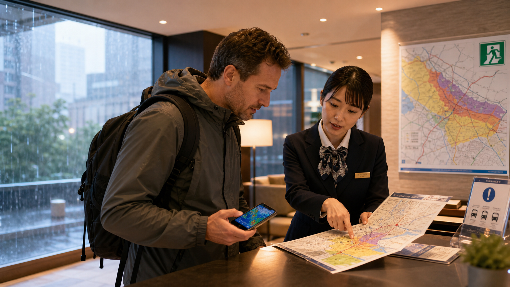
- Ask the hotel or facility about this building. Tell staff about mobility, medical, hearing, vision or language support needs before conditions worsen.
- Check each transport operator directly. A route-planning app may lag behind an official suspension notice.
What changed in 2026—and what the colors mean
The Japan Meteorological Agency (JMA) now aligns warning names more explicitly with the five-level disaster framework. Level 2 advisories call for preparation; Level 3 warnings indicate that older people and others who need more time should evacuate from dangerous places; Level 4 danger warnings indicate that everyone in a dangerous place should evacuate; and Level 5 emergency warnings indicate a life-threatening situation in which safe evacuation may already be difficult.
| Level / map color | Weather information you may see | Traveler response |
|---|---|---|
| 2 / yellow | Advisory (注意報) | Check the hazard map, charge devices, change exposed plans and learn the building’s procedure. |
| 3 / red | Warning (警報) | People needing extra time leave dangerous places; other travelers prepare to move immediately. |
| 4 / purple | Danger warning (危険警報), including Heavy Rain Danger Warning (大雨危険警報) | Everyone in a dangerous place evacuates according to municipal and facility instructions. Do not wait for Level 5. |
| 5 / black | Emergency warning (特別警報) | A disaster may be occurring. Protect life immediately in the safest available location; an outdoor journey may be more dangerous. |
A JMA “Level 4 equivalent” risk indication is not itself the municipality’s Evacuation Instruction (避難指示). Do not use that distinction as a reason to delay: official guidance says residents and visitors must also judge from current risk information. Conversely, Level 5 Emergency Safety Measures (緊急安全確保) is not a stage to wait for.
How to read Kikkuru without treating it as a decorative weather map
Kikkuru is JMA’s color-coded risk map for landslides, inundation and flooding. It updates roughly every ten minutes and includes short-range forecasts: landslide risk extends up to six hours ahead and flood risk up to three hours. Use location services cautiously and zoom to the accommodation and planned route; GPS drift, a low-resolution screenshot or the color at a nearby station can mislead.
- Yellow: start preparing and abandon optional exposed activities.
- Red: people who need more time should be leaving dangerous areas.
- Purple: danger is high; evacuation from dangerous places should be complete or underway—especially near mapped slopes and rivers.
- Black: a disaster is imminent or occurring. Do not assume you can still walk to a distant shelter.
Check the hazard type, not only the color. An upper floor may reduce shallow-flood exposure yet be unsuitable beside a landslide-prone slope. Underground shopping streets, basement restaurants and low underpasses can become dangerous quickly during inundation.
Use a source hierarchy, not a single convenient app
- JMA: warnings, Kikkuru and rainfall conditions.
- Municipality: evacuation instructions, opened shelters and local closures. Search the city or ward name plus hinan jōhō (避難情報).
- Railway, airline, bus or road operator: the status of that exact service.
- Hotel or attraction: building-specific safety instructions and closure decisions.
- JNTO: multilingual support through the Safety Tips app and Japan Safe Travel information.
Cross-check the timestamp. A translated repost, social-media video or yesterday’s map cannot establish present safety. Save official pages offline, but refresh them whenever connectivity returns.
“Planned suspension” changes the decision before the rain peaks
Keikaku unkyū (計画運休) means an operator plans to suspend service in advance. Unten miawase (運転見合わせ) means service is currently suspended; tsūkō-dome (通行止め) means a road is closed. Replacement transport is not guaranteed, and one operator reopening does not mean the connecting line, airport access or mountain road is safe.
When an operator announces a likely suspension, do not race across the city merely to preserve a reservation. First ask the hotel about extending the stay, then check every segment and the destination’s conditions. After reopening, crowds and further stoppages are possible. Keep receipts and operator notices if an insurer or booking provider requests evidence.
A shelter is not automatically safer than the building you are in
Follow municipal and facility instructions early. A designated evacuation site may be selected for one hazard but not another, and the route can cross a flooded road. If safe movement is still possible, evacuate before darkness and severe rain. If conditions have already become extreme, emergency safety action may mean moving to a higher, more robust part of the current building or another nearby safe building rather than crossing floodwater. Ask staff or emergency services; never improvise through moving water.
Travelers in a sturdy central hotel away from mapped river and slope hazards may be instructed to remain inside. A guest in a basement, riverside inn, low campsite or lodging below a steep slope may need to act much earlier. “Stay indoors” and “go to the nearest shelter” are not universal rules.
A ten-minute check before a heavy-rain day
- Save the accommodation address in Japanese, municipality name, front-desk number and insurance contact.
- Locate rivers, slopes, basements and evacuation sites on the official hazard map.
- Enable emergency notifications and install JNTO’s Safety Tips app; keep a charged power bank.
- Carry prescribed medicine, water, closed shoes and a light waterproof layer without panic buying.
- Move hikes, ravines, river activities, coastal walks and remote-road drives before warnings escalate.
- Tell companions where to reunite if networks fail, and never split up to retrieve luggage.
Useful Japanese and multilingual help
- Ōame keihō wa dete imasu ka? (大雨警報は出ていますか?) — Is a heavy-rain warning in effect?
- Koko wa hinan ga hitsuyō desu ka? (ここは避難が必要ですか?) — Do we need to evacuate from here?
- Hinanjo made no michi wa anzen desu ka? (避難所までの道は安全ですか?) — Is the route to the shelter safe?
- Densha wa unten miawase desu ka? (電車は運転見合わせですか?) — Is train service suspended?
For a life-threatening emergency call 119 for fire, ambulance or rescue, or 110 for police. JNTO’s 24-hour Japan Visitor Hotline supports English, Chinese and Korean at 050-3816-2787. Do not use emergency numbers for timetable questions.
Frequently asked questions
Does purple mean I should wait for an evacuation order?
No. Purple indicates a Level 4-equivalent dangerous situation. Check the municipality immediately and act from dangerous locations; do not wait for black or Level 5.
Can I rely on Google Maps for a safe route?
No single navigation app confirms flood depth, slope failure or an operator’s latest closure. Use it only after checking official hazard, municipal and transport information.
Is a hotel upper floor always safe?
No. It may help against some inundation, but fire, wind, structural and landslide risks differ. Follow building-specific and local instructions.
Official references: JMA: 2026 warning changes / JMA Kikkuru / Cabinet Office evacuation guidance / JNTO Japan Safe Travel / JNTO emergencies