



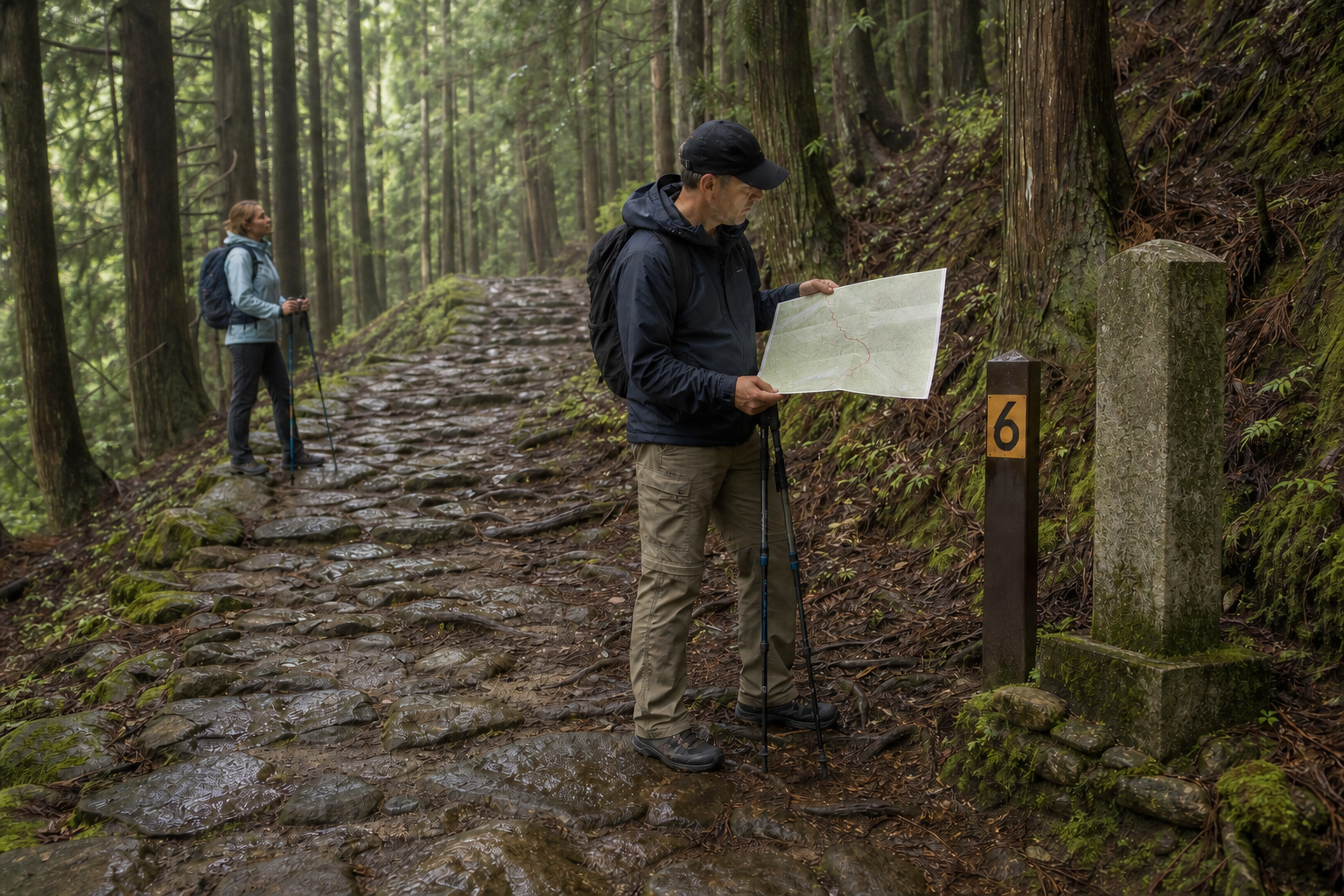
The Kumano Kodo is not one trail or the shortest sightseeing path between three shrines. It is a pilgrimage-route network across the mountainous Kii Peninsula, combining wet stone, steep earth, paved village roads, limited buses and small lodgings. Distance alone is a dangerous selection method. Using official information checked 26 August 2026, this guide joins route, transport, lodging, culture and exit decisions.
On the Kumano Kodo, walking itself is part of pilgrimage
For over a thousand years, retired emperors, aristocrats and ordinary people travelled toward Kumano. Nakahechi, Kohechi, Ohechi and Iseji are routes into the spiritual landscape centred on Kumano Hongu Taisha, Hayatama Taisha and Nachi Taisha. In 2004, designated route sections, sacred sites and cultural landscapes entered World Heritage as part of “Sacred Sites and Pilgrimage Routes in the Kii Mountain Range.” This does not mean every modern road or every metre called Kumano Kodo is inscribed.
Oji were subsidiary sacred places where pilgrims prayed, rested and prepared themselves. Read stone figures, villages, hot springs and transitions toward the Three Grand Shrines instead of racing only to a finish.
Choose the route family, then one day section
| Route | Character | First-visit decision |
|---|---|---|
| Nakahechi | Tanabe toward the Three Grand Shrines; relatively developed maps, lodging and buses | Easiest to segment or build over several days |
| Kohechi | Mountain traverse from Koyasan to Hongu | Experience, repeated climbs/descents and fixed lodging needed |
| Ohechi | Historic southwest-coast route | Check surviving trail, rail and road pieces individually |
| Iseji | Ise direction toward Kumano | Very broad; use Mie route maps and transport |
Official difficulty is comparison, not a personal safety guarantee. Check distance, cumulative ascent/descent, wet surface, pack, heat, daylight, bus and lodging. Do not choose Ogumotori-goe, Kogumotori-goe or Kohechi simply because the name is famous.
Three first sections: short does not mean easy
| Section | Official approximate data | Suitable for | Critical trap |
|---|---|---|---|
| Daimon-zaka | Slope about 1 km, about 30 min, difficulty 1.5 | Short Nachi stone-step experience | Full worship visit is longer; 267 wet steps |
| Hosshinmon-oji → Hongu Taisha | About 7.5 km, 2–3 hr; gain 190 m/loss 460 m | Day introduction through sacred sites and villages | No lodging at Hosshinmon; bus connection essential |
| Takijiri-oji → Takahara | About 4 km, 2–3 hr; gain about 430 m | Steep Nakahechi gateway | No bus at Takahara; nearest Kurisugawa about 30 min on foot |
Times assume conditions such as healthy walkers and good weather. Breaks, photos, children, heat and packs add time. Daimon-zaka’s 30 minutes does not include Nachi Taisha, Seigantoji and waterfall visits. A net-descending Hosshinmon day still has uneven ground and climbs.
Use Kii-Tanabe as a gateway and plan backward from the last bus
- For western Nakahechi, get maps and current advice at the Tanabe Tourist Information Center beside JR Kii-Tanabe.
- Date-search official stops and buses for Takijiri, Chikatsuyu, Hosshinmon and Hongu.
- Save not only the arrival bus but a mid/endpoint exit if you cannot continue and the final service.
- Do not assume IC-card payment; confirm cash, numbered ticket and boarding method.
- If transport fails, do not assume a taxi will appear—contact lodging and cancel/shorten.
Takahara has no bus; Hosshinmon has no lodging. Seeing a road does not prove public-transport escape. If the morning bus is missed, do not “make up” time with a late start.
Reserve lodging, dinner, lunch and luggage together
Walk-in accommodation is not normal in isolated villages. Small lodgings buy ingredients and organise transfers for booked guests, with fixed dinner times. Confirm bed, dinner/breakfast, next-day bento, allergy/vegetarian/religious needs, arrival time and pickup during booking. Ask about shared equipment and whether complete exclusion is possible; never assume same-day accommodation.
KUMANO TRAVEL is a local community reservation system, but submitting a request is not confirmation. Complete processed-request notice, payment deadline and cancellation terms. Luggage shuttles also require section, cutoff, size, service day and receiving-lodging confirmation. Carry valuables, medicine, rainwear, water and emergency essentials yourself.
Check detours and weather the day before, morning of, and at lodging
The tourism bureau’s Tips & Safety carries detour/closure notices. No listing is not proof of safety: after rain, fallen trees, swollen water, slips and bus rerouting can emerge rapidly. Layer JMA warnings, local authority, operator, information centre and lodging reports.
- Spring/autumn: popular, limited beds/buses, cold mornings/evenings.
- Summer: heat/humidity, WBGT, downpours, lightning, insects and dehydration; streams can rise quickly.
- Winter: short daylight, high-section ice/snow, closures and reduced service.
- Typhoon/rain band: cancel before arrival; never force an unofficial bypass.
Valleys darken before the published sunset. Official guidance presents arrival between 15:00 and 17:00 as a useful target; choose earlier according to season and lodging deadline.
Move for wet stone and roots, not a social-media trail
- Broken-in hiking shoes with grip; never debut footwear on the pilgrimage.
- Separate rain jacket/trousers, quick-dry layers, seasonal warmth/sun protection.
- Official paper plus offline map and pencil; not one phone alone.
- Water, bento/snacks, medicine, first aid, headlamp, power and cash.
- Practised poles; small steps downhill; do not jab heritage stones or wooden bridges.
Official guidance says many injuries are slips/falls on stone and roots. Avoid pushing off mossy stone, and read wet bridges, leaves and roadside slopes. Match every numbered waymarker to the map and record it. A number helps explain position; it does not replace rescue communication.
Respect oji, the Three Shrines and living roads
- Be quiet at shrines, stone figures and temples; follow access, photography and worship routes.
- Stay out of private homes, gardens, fields and cemeteries; avoid early/late noise.
- Carry all waste/bento containers; take no plant, stone, wildlife or offering.
- Stay on route, use no fire, and camp only at booked official sites.
- Treat stamps/credentials as pilgrimage records, not a speed-collection game.
World Heritage does not freeze every cobble unchanged. Faith, conservation, forestry, village life and disaster protection overlap in this cultural landscape. Closures and repair are part of preserving it.
Solo walkers, children, wildlife and emergencies
Official guidance recommends a walking partner. Solo walkers should share route, markers and arrival with lodging/family; establish check-ins and no-signal procedure; carry insurance including evacuation. An inexperienced walker should not begin Kohechi or Kumotori passes alone. Judge children by gradient, slip, heat, focus, toilets and bus exits—not kilometres—and never assume one adult can manage several small children in remote terrain.
Do not seek mamushi snakes, hornets, ticks or rare bears. Keep distance, do not touch/feed and follow seasonal official advice. Do not force an injured person to walk. Call 119 and lodging; without signal, keep the group organised while an able companion reaches the nearest safe contact point.
From booking to the morning start
- Select a day section, cumulative elevation, official rating, markers and exits—not merely a route name.
- Save confirmed lodging, meals, bento, transfer, luggage and dietary responses.
- Save buses/final service, cash and the cancellation option for disruption.
- Check closure, warning, WBGT, thunder and darkness the day before and morning.
- Confirm gear, insurance, partner, route sharing, 119/110 and arrival message.
- Shorten/stop early with delay, pain, saturation, heat, rising water or darkness.
The aim is not to conquer kilometres. It is to walk safely and pass onward a route shaped by worship and local life. Early booking, light packs, early starts and early retreat create space to understand the culture.
Official sources: Tanabe City Kumano Tourism Bureau, its section data/maps/Tips & Safety, and KUMANO TRAVEL. Checked 26 August 2026.